National Geographic Maps
Jasper North Map (Jasper National Park)
Jasper North Map (Jasper National Park) is backordered and will ship as soon as it is back in stock.
Couldn't load pickup availability
Delivery and Shipping
Delivery and Shipping
Jasper North Map (Jasper National Park)
Description
Description
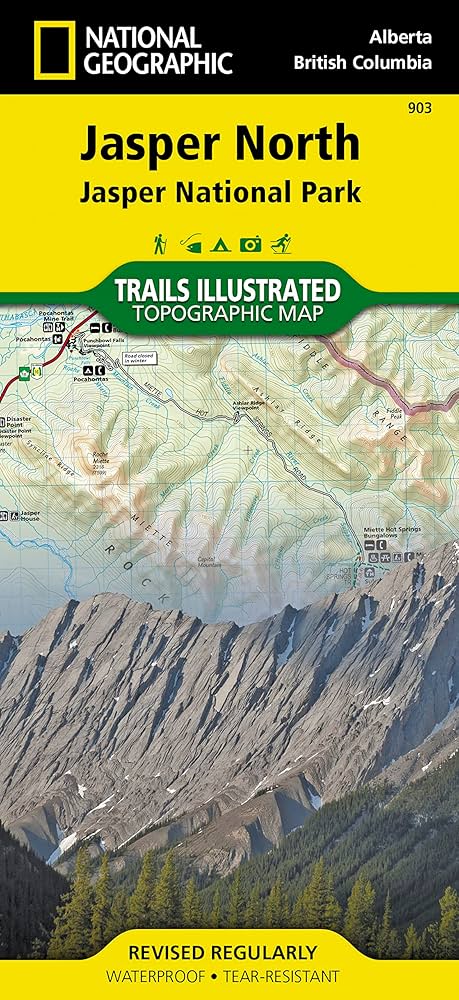
Explore the Wilderness with National Geographic Maps: Jasper North
The largest park in the Canadian Rockies, Jasper National Park is a UNESCO World Heritage Site with breathtaking mountain scenery and bountiful recreational opportunities. Expertly researched and created in cooperation with Parks Canada and others, National Geographic's Trails Illustrated map of Jasper North delivers unparalleled detail of the park from the town of Jasper in the south to its northern boundary. Coverage includes many popular points of interest such as Miette Hot Springs, Maligne Canyon, Pyramid Lake and Mountain, Calumet Glaciers, Celestine Lake and Snake Indian River, as well as the town of Jasper. Also covered are adjacent areas of Rock Lake-Solomon Creek Wildland Park, Mount Robson Provincial Park and Willmore Wilderness Park.
Payment & Security
Payment methods
Your payment information is processed securely. We do not store credit card details nor have access to your credit card information.